How can I use the Pedestrian Portal?

Explore the Greater Philadelphia region’s sidewalk inventory. Use the Explore tools to find pedestrian features on the map. Click on features (like a ramp, sidewalk, or crosswalk) to view relevant attributes (such as location, status, and more).

Learn more about how to use the Explore tools.

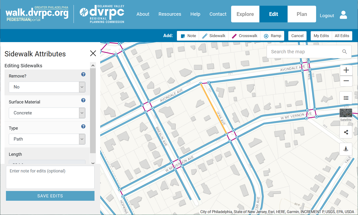
Edit our pedestrian network map to make sure it’s up to date. All can register to create an account to access the Edit tools. Use the Edit tools to find and select existing pedestrian features (like ramps, sidewalks and crosswalks) and review and edit the relevant attributes. You can also add notes, sidewalks, crosswalks, and ramps to the map. And you can sort and view your own edits, as well as edits made by others.

Learn more about how to use the Edit tools.

Plan your next pedestrian project to join a shared conversation about walkability in our region. If you’re a planner in our region, you can register to request access to the Plan tools. Use the Plan tools to create pedestrian projects that can be private or viewable by other planners. Add features to your projects using point, line and shape tools. You can also sort and view your projects as well as projects shared by others.

Learn more about how to use the Plan tools.

You can also use the Pedestrian Portal’s informational webpages to learn more about the project, find resources, get help, and sign up for updates.